1.1 Latitude And Longitude
Name:Date: Period:Mapping the EarthThe Physical Setting: Earth ScienceLab Activity: Latitude and LongitudeINTRODUCTION:!The system that is used to locate and describe your position on Earth’s surface is latitude and longitude. Originally used by cartographers for creating maps and captains for navigation on the openocean, latitude and longitude has become a part of nearly everyone daily life. Whether using turn-byturn directions with your GPS device or locating a friend’s location, latitude and longitude are the basisfor many different applications in every day life.OBJECTIVE:!You will learn how to locate the star Polaris in the nighttime sky and to determine positions on Earthusing the coordinate system of latitude and udePrime Meridian!Geographic Poles! !Leigh-Manuell - "1
Lab Activity: Latitude and LongitudePROCEDURE A:!1. Locate the big dipper (bright group of stars in the constellation Ursa Major).2. Following the pointer stars, move five times the distance that separates the pointer stars.3. Circle the star and label it Polaris.4. Label on the diagram (in the space provided) the direction an observer would be facing.Observer’s Direction:Leigh-Manuell - "2
Lab Activity: Latitude and LongitudePROCEDURE B:!1. Trace over the Equator and Prime Meridian.2. Use the World Map below to locate and record the approximate latitude and longitude coordinates on to Report Sheet 2 (include compass directions).3.WORLD MAP!REPORT SHEET 1!BFGCAEDREPORT SHEET 1!LocationLatitudeABCDEFGLeigh-Manuell - "3Longitude
Lab Activity: Latitude and LongitudePROCEDURE C:!1. Trace over the Equator and Prime Meridian.2. Use the Data Chart and World Map provided below to plot the following latitude and longitudecoordinates. Be sure to label each point with the correct letter.DATA CHART !LocationLatitudeLongitudeA40º N160º WB40º S40º EC20º S80º WD80º N120º WE0º0ºWORLD MAP!Leigh-Manuell - "4
Lab Activity: Latitude and LongitudePROCEDURE D:!Use the New York Map to locate and record the approximate latitude and longitude coordinates ofthe listed cities and geologic features on to Report Sheet 2 (include compass directions).NEW YORK MAP!DATA CHART 2!LocationLatitudeWatertownMt. MarcySlide MountainOswegoLeigh-Manuell - "5Longitude
Lab Activity: Latitude and LongitudeDISCUSSION QUESTIONS:!1. What is the largest possible latitude that one can reach?2. What is the latitude of the South Pole?3. Explain why two circles of latitude never touch?4. What is your exact location if you are crossing the Prime Meridian and the altitude of Polaris is 50 .5. On the surface of the Earth, it is approximately 6,200 miles from the equator to the North Pole orSouth Pole. How many miles is it between two parallels 1 apart?6. What is the maximum number of degrees of longitude possible?7. Explain why the distance between two meridians at the North Pole is 0 miles?CONCLUSION: Describe how latitude and longitude coordinates are used to locate positions on Earth?Leigh-Manuell - "6
Date: _ Period: _ The Physical Setting: Earth Science. PROCEDURE A:! 1. Locate the big dipper (bright group of stars in the constellation Ursa Major). 2. Following the pointer stars, move five times the distance that separates th
Latitude 3150 Latitude 3160 Latitude 3180 Latitude 3189 Latitude 3330 Latitude 3340 Latitude 3350 Latitude 3380 Latitude 3450 Latitude 3460 Latitude 3470 Latitude 3480 Latitude 3490 Latitude 3550 Latitude 3560 . EMC Storage HW - VNX
Latitude & Longitude Facts Various questions on the meaning of latitude and longitude and important lines of latitude and longitude. Understand the concept of latitude and longitude applied together. Apply the use of latitude and longitude together to locate and compare positions between items on maps. Enter the Latitude & Longitude I
Lines of latitude are also called parallels because the lines run parallel to the equator. Each line of latitude is about 69 miles apart. Lines of longitude are called meridians. Latitude and longitude are measured in degrees. equator Latitude and Longitude is written: is the degree ' is the minutes " is the seconds longitude latitude Prime .
3. map with longitude and latitude lines 4. Slips of paper with longitude and latitude locations that can be located on drop cloth. 5. checklist (Appendix C ) 6. Longitude/Latitude Assessment (Appendix D ) C. Key Vocabulary 1. Longitude: (meridians) imaginary lines going from the north to the south, but dividing the globe east and west.
3 Latitude and Longitude Answer the following questions: 1. Research the lines of latitude and longitude 2. Explain how to use them to locate places on Earth. 3. explain degrees and minutes 4. Explain the main lines of latitude and longitude. 5. What is the latitude and longitude for Rainham? London? Edinburgh? Cardiff? Manchester? Dr. Nagler's .
- Introduce latitude and longitude and its usage. - Practice locating different areas in the maps using latitude and longitude. Day 5 - Teacher will review the importance of maps, globes, latitude, and longitude. - Have students reflect on what they have learned during the week through a KWL Chart.
2. Use the Data Chart and World Map provided below to plot the following latitude and longitude coordinates. Be sure to label each point with the correct letter. DATA CHART ! WORLD MAP! Leigh-Manuell - "4 Lab Activity: Latitude and Longitude Location Latitude Longitude A 40º N 160º W B 40º S 40º E C 20º S 80º W D 80º N 120º W E 0º 0º
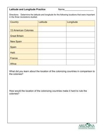
Latitude and Longitude Practice Answer Key Directions: Determine the latitude and longitude for the following locations that were important in the three revolutions studied. Country Latitude Longitude 13 American Colonies 40o North 80o West Great Britain 50o North 0o New Spain 24o North 1


