Latitude/Longitude: Message In A Bottle - 3rd Grade Counts .
Latitude/Longitude: Message in a BottleGlenda SullivanOKAGE Teacher Consultant, Lawton, OklahomaWorld Geography Academy – Session IIIWednesday, November 17, 2010University of Oklahoma, NormanMaterials may only be reproduced for the classroom and presentationswhen proper acknowledgement is given to the author andthe Oklahoma Alliance for Geographic Education.100 East Boyd, SEC Rm 442 Norman, OK 73019-1018 405.325.5832 800.522.0772 x 5832www.okageweb.org okage@ou.edu
Glenda SullivanOklahoma Alliance for Geographic EducationAll materials may be reproduced for the classroom and presentations only whenproper acknowledgement is given to the author and the Oklahoma Alliance forGeographic Education.
LATITUDE/LONGITUDE:MESSAGE IN A BOTTLEGlenda Sullivan, OKAGE TCLawton, OklahomaGrade Level:6th-7thPurpose/Overview:Students will become more proficient in finding absolute locations by playing a board gamewhich employs latitude and longitude coordinates to locate survivors of a shipwreck.National Geography Standards from Geography for LifeGeographic Elements & Standards:Standard 1 – The World in Spatial Terms: how to use maps and other geographicrepresentations, tools, and technologies to acquire, process, and report information from a spatialperspective.Oklahoma Priority Academic Student Skills:Grade 6 World Studies:1.2 – Identify, evaluate, and draw conclusions from different kinds of maps, graphs,charts, diagrams, timelines, and other representations such as photographs andsatellite-produced images or computer-based technologies.2.1 – Apply the concepts of scale, orientation, latitude and longitude, and physicalregions.Grade 7 World Geography1.2 – Apply the concepts of scale, distance, direction, relative location, latitude andlongitude.6.1 – Evaluate and draw conclusions from different kinds of maps, graphs, charts,diagrams, and other sources and representations (e.g., aerial and shuttle photographs,satellite-produced images, the geographic information system (GIS), atlases, almanacs,and computer-based technologies).Geographic Themes:LocationObjectives:1. Students will review the concept of latitude and longitude.2. Students will understand that by using latitude/longitude coordinates, absolutelocations can easily be found on a map.3. Students will become more competent in finding absolute locations by playing aboard game which employs latitude and longitude coordinates to locate survivors of ashipwreck.
Materials:1. Message in a Bottle Game Board (attached to this lesson)2. Latitude and Longitude Cards attached to this lesson (Cut apart and put in separateenvelopes labeled Latitude and Longitude)3. 20 Castaway Markers (pennies)Time Frame:1 class periodProcedures:1. Show PowerPoint “Latitude/Longitude: Message in a Bottle” to review the followingconcepts of latitude and longitude:The equator (0º) is the starting point for measuring latitude.Latitude lines are horizontal lines that run parallel to the equator; those above theequator denote north (N) latitude while those below the equator denote south (S)latitude.The prime meridian (0º) is the starting point for measuring longitude.Vertical longitude lines to the right of the prime meridian denote east (E) longitudewhile those to the left of the prime meridian denote west (W) longitude.Latitude is always stated first. (Example: 40ºN, 100ºW)0º latitude and 0º longitude are never labeled with a direction.Examples: 0º, 20ºE and 40ºN, 0º (Remember, latitude is written first.)2. The following example is a fun way to help Oklahoma students remember to locatelatitude first: if the student is an OU fan, think over and up; if the student is an OSUfan, think over and straight up.3. Divide students into groups of two. Play "Message in a Bottle” board game.(Instructions, latitude/longitude cards and pattern for game board are attached.)Adapted from the following ent:Participation grade for playing the game “Message in a Bottle” which employslatitude/longitude skills.Resources:About.com: Discover the Secrets of Parallels and gitude/a/latlong.htmWorld map with latitude, longitude, equator and prime meridian lustrations of lines of latitude and latitudelongitude.jpgExtension and Enrichment1. Latitude/longitude is a concept on which students continually need practice tomaintain the skill. Give students several latitude/longitude locations for each unit ofstudy throughout the school year.
2.1 – Apply the concepts of scale, orientation, latitude and longitude, and physical regions. Grade 7 World Geography 1.2 – Apply the concepts of scale, distance, direction, relative location, latitude and . Latitude/longitude is
Latitude 3150 Latitude 3160 Latitude 3180 Latitude 3189 Latitude 3330 Latitude 3340 Latitude 3350 Latitude 3380 Latitude 3450 Latitude 3460 Latitude 3470 Latitude 3480 Latitude 3490 Latitude 3550 Latitude 3560 . EMC Storage HW - VNX
Latitude & Longitude Facts Various questions on the meaning of latitude and longitude and important lines of latitude and longitude. Understand the concept of latitude and longitude applied together. Apply the use of latitude and longitude together to locate and compare positions between items on maps. Enter the Latitude & Longitude I
Lines of latitude are also called parallels because the lines run parallel to the equator. Each line of latitude is about 69 miles apart. Lines of longitude are called meridians. Latitude and longitude are measured in degrees. equator Latitude and Longitude is written: is the degree ' is the minutes " is the seconds longitude latitude Prime .
3. map with longitude and latitude lines 4. Slips of paper with longitude and latitude locations that can be located on drop cloth. 5. checklist (Appendix C ) 6. Longitude/Latitude Assessment (Appendix D ) C. Key Vocabulary 1. Longitude: (meridians) imaginary lines going from the north to the south, but dividing the globe east and west.
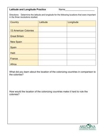
Latitude and Longitude Practice Answer Key Directions: Determine the latitude and longitude for the following locations that were important in the three revolutions studied. Country Latitude Longitude 13 American Colonies 40o North 80o West Great Britain 50o North 0o New Spain 24o North 1
3 Latitude and Longitude Answer the following questions: 1. Research the lines of latitude and longitude 2. Explain how to use them to locate places on Earth. 3. explain degrees and minutes 4. Explain the main lines of latitude and longitude. 5. What is the latitude and longitude for Rainham? London? Edinburgh? Cardiff? Manchester? Dr. Nagler's .
- Introduce latitude and longitude and its usage. - Practice locating different areas in the maps using latitude and longitude. Day 5 - Teacher will review the importance of maps, globes, latitude, and longitude. - Have students reflect on what they have learned during the week through a KWL Chart.
Latitude & Longitude 1) Which lines are parallel and never intersect: Latitude or Longitude? 2) Which lines converge at the poles: Latitude or Longitude? 3) Latitude lines run [east-west or north-south?]. 4) Longitude lines run [east-west or north-south?]. 5) The Earth is divided into how many time zones?


