Year 5 Geography Unit 2018 Factors That Shape Places
Year 5 Geography Unit 2018Factors That Shape PlacesTerm:Three and FourDuration:20 weeksGrade:FiveYear:UNIT OVERVIEWOUTCOMESStudents investigate how people change the naturalenvironment in Australia and other places around the world.They also explore how the environment influences the humancharacteristics of places. Students examine ways peopleinfluence the characteristics of places, including themanagement of spaces. Students explore the impactbushfires have on Australian people, places andenvironments and propose ways people can reduce theimpact of bushfires in the future.GEOGRAPHICAL CONCEPTS2018GE3-1:Describe the diverse features and characteristics ofplaces and environmentsGE3-2:Explains interactions and connections betweenpeople, places and environmentsGE3-3:Compares and contrasts influences on themanagement of places and environmentsGE3-4:Acquires, processes and communicates geographicalinformation using geographical tools for inquiryGEOGRAPHICAL INQUIRY SKILLSGEOGRAPHICAL TOOLSThe following geographical concepts havebeen integrated into the unit:The following geographical inquiry skills have been integrated into the unit:Acquiring geographical informationThe following geographical tools have beenintegrated into the unit:Place: the significance of places and what theyare like Maps – MSpace: the significance of location and spatialdistribution, and ways people organise andmanage spaces that we live inEnvironment: the significance of theenvironment in human life, and the importantinterrelationships between humans and theenvironment.Interconnection: no object of geographicalstudy can be viewed in isolationSustainability: the capacity of the environmentto continue to support our lives and the lives ofother living creatures into the futureChange: explaining geographical phenomenaby investigating how they have developed overtimedevelop geographical questions to investigate and plan an inquiry (ACHGS033, ACHGS040)collect and record relevant geographical data and information, using ethical protocols, from primary data andsecondary information sources, for example, by observing, by interviewing, conducting surveys, or usingmaps, visual representations, statistical sources and reports, the media or the internet (ACHGS034,ACHGS041)Processing geographical information evaluate sources for their usefulness (ACHGS035, ACHGS042) represent different types of geographical information by constructing maps that conform to cartographicconventions using spatial technologies as appropriate (ACHGS036, ACHGS043)represent data in different forms, for example plans, graphs, tables, sketches and diagrams (ACHGS035,ACHGS042) interpret geographical data and information, using digital and spatial technologies as appropriate, and identifyspatial distributions, patterns and trends, and infer relationships to draw conclusions (ACHGS037,ACHGS044)Communicating geographical information present findings and ideas in a range of communication forms as appropriate (ACHGS038, ACHGS045) reflect on their learning to propose individual and collective action in response to a contemporarygeographical challenge and describe the expected effects of their proposal on different groups of people(ACHGS039, ACHGS046) large-scale maps, small-scale maps, politicalmaps, topographic maps, flowline maps maps to identify location, spatial distributionsand patternsGraphs and statistics – GS 1multiple graphs on a geographical themestatistics to find patternsFieldwork – F observing, measuring, collecting and recordingdata, conducting surveys and interviews.Spatial technologies – ST virtual maps, satellite images, global positioningsystems (GPS)Visual representations – VR Alice Vigors - 2018pictographs, data tables, column graphs, linegraphsphotographs, illustrations, flow diagrams,multimedia, web tools
ESSENTIAL INQUIRY QUESTIONSHow do people andenvironmentsinfluence oneanother?How do peopleinfluence places andthe management ofspaces within them?How can the impactof bushfires onpeople and placesbe reduced?CONTENTFactors that change environmentsEnvironments shape placesStudents:Students: investigate the ways people change investigate how the naturalthe natural environment in Australiaenvironment influences people andand another country, for example:places, for example:o examination of how people,o discussion of how climateincluding Aboriginal and Torresinfluences the distribution ofStrait Islander Peoples, havewhere people liveinfluenced each country’so comparison of how landformsenvironmental characteristicsinfluence where and howe.g. land clearingpeople live in Australia andanother countryAlice Vigors - 2018Humans shape placesBushfire HazardStudents:Students: investigate how people influence places, investigate the impact of ONEfor example:contemporary bushfire hazard ino description of who organises andAustralia, for example:manages places e.g. local and stateo identification of the location andgovernmentsextent of the disastero identification of ways peopleo description of the impact of theinfluence places and contribute todisaster on natural vegetation andsustainability e.g. roads andthe damage caused to communitiesservices, building developmento examination of how people canapplications, local sustainabilityprevent and minimise the effects ofinitiativesa bushfireo examination of a local planningissue; the different views about itand a possible action in response toit2
TUNING IN TO THE INQUIRYReviewing Tuning In Data(What did the tuning in tasks reveal to us about students’ interests and needs? Whatquestions did they pose that can help drive learning?)Tuning In(Baseline Data) How can weassess students’prior knowledgeand experiencein relation to thiscontext? How will werecord thisinformation forlaterassessment? What can we doto PROVOKEinterest/enthusiasm/curiosity/motivation? How can weassist students tomake“conceptualconnections” andsee relationshipsto and links withtheir own lives?Alice Vigors - 2018 Examine a range of images depicting Australia’s vastlydifferent environments Use the thinking routine See Think Wonder to exploreand discuss Australia’s natural environmentso What do you see, observe or notice abouteach of these environments?o What does it make you think about Australia’snatural environments?o What does it make you think about how weinfluence the environment and theenvironment influences us?o What do you wonder? Watch Land Beyond Time – Australia (stop at 9:30)https://youtu.be/b9 Ie60pxe0 Explore student thinking and wonderings. Categorisewonderings into the three key content areas. Pairs or small groups choose a wondering and discussways they might be able to explore this question.EXTRA: Australia the beautiful episode 1: desert & wetlandshttps://www.youtube.com/watch?v EPKSDwXxWAY3
CONTENTEnvironmentsShape PlacesStudents: investigate howthe naturalenvironmentinfluences peopleand placesLEARNING AND TEACHING: SHARED INQUIRYKey Inquiry QuestionsHow do people and environments influence one another?How do people influence places and the management of spaces within them? Use the thinking routine Chalk Talk (non-silent) to have students unpack a variety ofdifferent environments in pairs, using words and/or illustrations. For example: deserts,coastal, rainforests, grasslands, mountains. Pairs need to examine:o What are the characteristics or main qualities of these environments?o What factors might change and/or influence these environments?o Are there any connections you can make?Curriculum Links: English Introduce geographical terms and add these to the mind map if not already there. Examine maps and discuss How Australia’s climate affects its population distribution?(Coastal for lifestyle, different regions for different agricultural needs)EVALUATIONRESOURCES Images ofAustralianenvironments Maps Compare: Somersby Falls, Melbourne, Simpson Dessert, Great Barrier Reef. Providestudents with a range of environments (e.g. coastal, Great Barrier Reef, bush,urban/metropolitan, deserts) and provide above scaffolded questions to discuss. Research Task: Students research characteristics of dry, temperate and tropicalclimates (Aus. climate zones website/world biomes for more world biomes.htm Assessment: Give students a copy of Australia’s climate map and population map(see maps folder). Students record in their books the answer to the Questions:o Is there a link between climate and population?o How does climate influence the distribution of where people live?Answers focus on access to water, food, comfort, jobs. Students use google docs orslides to record and share their learning. Must include map showing climate andpopulation in Australia. (GE3-1, GE3-2, GE3-4)Alice Vigors - 20184 Climate map Population map Chromebooks
CONTENTFactors ThatChangeEnvironmentsStudents: investigate theways peoplechange thenaturalenvironment inAustralia andanother countryCurriculum Links: EnglishAlice Vigors - 2018LEARNING AND TEACHING: SHARED INQUIRYKey Inquiry QuestionsHow do people and environments influence one another?How do people influence places and the management of spaces within them?How did Indigenous people impact the environment prior to settlement? View the traditional Indigenous story of ‘Baiames Ngunnhu - the story of BrewarrinaFish Traps’ (2nd Indigenous heritage listed site) - told by Aunty June Barker tosupport understanding. https://youtu.be/sq0fDD8nPuU Watch ‘Fishing’ and discuss Bunda’s solution for catching the fish and what effect thishad on the environment. http://www.myplace.edu.au/teaching activities/1878 before time/beforetime01bunda/2/fishing bt.html Read Indigenous Changes to the Environment (Google Doc) shared text? Discuss how Indigenous Australians utilised the land and how this affected theenvironment, e.g. fishing traps, fire-stick farming, agriculture and farming. Create atable to record 1-2 examples of Indigenous land use and how it affected theenvironment. Students think and record their opinion of the method. Explore cultural and survival activities Indigenous people undertook and discuss thepurpose these activities had in their lives. (Google Doc) Brainstorm the effect theseactivities might have had on the environment using a Think Pair Shareo Think: about the effects and record ideaso Pair: with another student to discuss and expand ideaso Share: with the class and record student responses Identify the traditional peoples of the Central Coast (Darkinjung) explore a map ofIndigenous Australia Identify Central Coast on a map of New South Wales and describe the environment ofour region. Read The Darkinjung People and the Central Coast (Google Doco List the cultural and survival activities undertaken in this region.o What impact did these activities have on the environment of the CentralCoast?o What evidence of this impact can still be seen today? Assessment: Examine two local images. Identify how the environment has changedand whether the changes are natural or man-made. Explain the effects these changeshave had on the environment and native flora and fauna (GE3-1, GE3-2, GE3-4)5EVALUATIONRESOURCES Copies of text Indigenous map Map of NSW Copies of text Local images
CONTENTHumans ShapePlacesStudents: investigate howpeople influenceplacesLEARNING AND TEACHING: SHARED INQUIRYKey Inquiry QuestionHow do people influence places and the management of spaces within them?What is it like to live here on the Central Coast? Gather images and make some connections to the places and environments in otherparts of Australia Display and group investigation of the diverse ways people live on the Central Coastand explore the qualities in living here and some of the drawbacks.Curriculum Links:https://www.centralcoast.nsw.gov.au/ English Assessment: Showcase/ exhibition: I’m at Coastie!What is zoning?**Reef Beat textposters: Read and discuss summary of information about zoning and how it works. Classhttps://goo.gl/SBGsbxsummary of what zoning means and its purpose.https://goo.gl/VaeQcb Summary of information about zoning and how it works at is zoning.htm Research groups - students research the four general categories of zoning (Residential, Commercial, Industrial & Agricultural) Students investigate zoning in their local area. Search for zoning maps on Wyong/Gosford local council’s websites for various uses of all the places in the area. Compare and contrast desirable & undesirable human characteristics that may be aresult of town planning Where to Build in the Neighbourhood http://www.urbangrowth.nsw.gov.au/minisites/my neighbourhood/decision maker/site.htmWhat is all the fuss about the Great Barrier Reef?Reef Beat Education Examine what a heritage listed area is & how the World Heritage convention helpsSeriesAustralia maintain the GBR. Locate the GBR on a map?http://www.gbrmpa.go Great Barrier Reef: http://education.abc.net.au/home#!/media/1422989 /ov.au/learn-abouto Use the 1 thinking routine to help students record information from videothe-reef/reef-beato World Heritage site: http://www.abc.net.au/btn/story/s3958277.htmseries What are the challenges to maintaining the GBR? How does the government manageindustry use of and around the GBR?o Examine a range of challenges facing the Great Barrier Reef. Choose onechallenge to debate and compose a persuasive text about.o Debating the future of the reef: -great-barrier-reef-debateo ABC News article: https://goo.gl/8JjGRAo Dredging study: https://goo.gl/EzrBTu Assessment How can we continue to maintain and protect it? Create a piece toinform others about GBR – advertisement, short film, persuasive letter etc.Alice Vigors - 20186EVALUATIONRESOURCES Images Exhibitionmaterials Chromebooks
CONTENTBushfire HazardStudents: investigate theimpact of ONEcontemporarybushfire hazardin AustraliaLEARNING AND TEACHING: SHARED INQUIRYKey Inquiry QuestionHow can the impact of bushfires on people and places be reduced? View photos/videos of Australian bushfires. Combine the thinking routines See ThinkWonder and Chalk Talk to examine the magnitude and devastation of bushfires.o What do you see, observe or notice about these bushfires and how theybehave?o What do you think a bushfire is? How do you think bushfires burn? How do youthink the impact of bushfires might be reduced?o What do you wonder about bushfires?*Useful Source: https://www.gtav.asn.au/documents/item/153 riculum Links: English Mathematics Creative Arts(Visual Arts & Drama) Read the text Bushfires by Jackie French Science (Earth &Space) Explore (or revisit) traditional Indigenous methods of burn off and land managementregarding bushfires and compare to local land use and protection (eg contact FireBrigade) http://www.fire.nsw.gov.au/page.php?id 879 Research Task: Small groups create a map of the major fires in their given region overthe past 10 years. The maps can be created online or by hand but should beinteractive, including images, videos, quizzes, pop-ups or flaps etc. Groups shouldconsider the following question prompts:o When and Where did the fire happen?o Where did it start and where did it spread to?o How was it started? Did it start naturally or was someone responsible forstarting it?o How much damage did the fire cause (human cost, environmental coast)?o How was the fire managed?Useful source: bushfire-seasons/o The Guardian bushfire history https://goo.gl/iRgMHq Locate the area of the Lake Munmorah fires of 2013 on Google Maps. View newspaperreports about the fire during and after.o Onboard footage from firetruck https://goo.gl/wrHz6p (mute sound due to somecourse language)o Rural Fire Brigade footage with backing music https://goo.gl/XXzQiVo Fire footage https://goo.gl/LJcniqAlice Vigors - 20187EVALUATIONRESOURCES Images Chromebooks
CONTENTBushfire HazardStudents: investigate theimpact of ONEcontemporarybushfire hazard inAustraliaLEARNING AND TEACHING: SHARED INQUIRYKey Inquiry QuestionHow can the impact of bushfires on people and places be reduced?o Daily Telegraph: Big Prawn Survives https://goo.gl/hMbdfKo Daily Telegraph: 1st anniversary https://goo.gl/heviTAo Sydney Morning Herald image compilation https://goo.gl/952CsvEVALUATIONRESOURCES Copies of text Assessment: Investigate the impact of the 2013 bushfires in Lake Munmorah.HumanCauseManagementEnvironmental CostFuture DirectionCurriculum Links:Cost English Mathematics Creative Arts (VisualArts & Drama) Literacy task: Comic book edit bushfire https://goo.gl/vJNr7p Science (Earth & Visual Arts: use a variety of mediums to depict a bushfire and/or the aftermathSpace) Drama: Ashes remembered unit Exploring the Geosix story (Teach through Taskboard in reading groups)The GeoSix and the bushfire (PDF, 333 KB) can be read together as a class, in smallgroups, or individually. There are particular places indicated where the story stops toallow students to write their own versions of events, or to do tasks similar to thosebeing done by children in the story. The suggested activities are:o At the end of Chapter 1: At this point you should stop the story and ask thestudents to write their own version of the next events.o Part way through Chapter 2: At this point the class might undertake theactivities suggested by the Geosix. Complete the gathering of informationbefore comparing it to what the GeoSix found.o Part way through Chapter 3: At this point students can be asked to suggestpossible answers to Dominic's question: ' but what has changed to makebushfires into the dangerous monsters they have become?' This may lead toclass discussion and debate before the next section is read. Assessment: Students create a Google Slide presentation to outline key aspects ofBushfire prevention.Alice Vigors - 20188 Chromebooks
Going Further – Pathways & Possibilities for Independent InquiryReflection & ActionHow can we cater for individual and small group pathways as they emerge during theunit? How will we facilitate students’ personal inquiries related to this topic? How canwe encourage students to make choices about what and how they will learn?(NOTE: individual teachers will need to add to documentation of the unit oncepersonal inquiry pathways have been established)How can we empower students to act on what they have learnt? How can we assiststudents to pull it all together and reflect on their learning? How can we encouragehigher order thinking (synthesis evaluation throughout the inquiry? What thinkingroutines would help this?)Alice Vigors - 20189
Text Ideas – Compiled by Shellie Tancred https://www.smore.com/92yc6-geographyAlice Vigors - 201810
- 2018 1 Year 5 Geography Unit 2018 Factors That Shape Places Term: Three and Four 2018Duration: 20 weeks Grade: Five Year: . Students investigate how people change the natural environment in Australia and other places around the world. They also explore how the environment influences the human characteristics of places. Students examine ways .
B. Geography . 3 H u m a n / P h y s i c a l TEACHER’S NOTE: Prior to the comple-1. Elements of geography . Geography tion of the two-year global history and a. Human geography . Movement of . geography program, students should . b. Physical geography . People and have a clear understanding of the human c. Political geography . Goods . and .
systematic geography is divided into four main branches. GEOGRAPHY MODULE - 1 The study of Geography as a discipline Notes 5 Nature of Geography as a discipline (i) Physical geography, (ii) Biogeography, including environmental geography, (iii) Human geography, (iv) Geographical methods and techniques
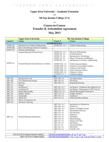
GEOG 100 Introduction to Physical Geography GEOG-101 (3) Physical Geography GEOG 200 World Regional Geography GEOG-108 (3) World Regional Geography GEOG xxx General Education Social Science GEOG-102 (3) GEOG-107 (3) GEOG-111 (3) Cultural Geography Urban Geography Geography of California HEALTH SERVICES ADMINISTRATION HSA 205 Intro to the .
4 Syllabus Paper-II : Human Geography Section-A Definition, aims and scope of Human Geography, relation of Human Geography with other social sciences. Principles of Human Geography. Essential facts of Human Geography according to Brunhes and Huntington. Schools of thought in Human Geography : Determinism, Stop and go determinism and
2 1. Geography is the study of places and people. 2. Studying location is important to both physical and human geography. 3. Geography and history are closely connected. Physical geography and human geography contribute to the study of history. Main Ideas The Big Idea Key Terms geography, p.
Social Studies Unit Plan - Second Grade Geography Overview/Introduction: The primary focus for this second grade Social Studies unit is the understanding of community geography. The standards used in this unit plan can be taught throughout a section of the year but can always be revisited as they are foundational geography concepts.
Test Name Score Report Date March 5, 2018 thru April 1, 2018 April 20, 2018 April 2, 2018 thru April 29, 2018 May 18, 2018 April 30, 2018 thru May 27, 2018 June 15, 2018 May 28, 2018 thru June 24, 2018 July 13, 2018 June 25, 2018 thru July 22, 2018 August 10, 2018 July 23, 2018 thru August 19, 2018 September 7, 2018 August 20, 2018 thru September 1
Geography 4 Year Plan Coege o Letters and Science Geography 414-229-4866 npapakis@uwm.edu uwm.edu/geography Degree Requirements for a Bachelor of Arts with a Geography major (brief summary): (Geography is also available as a Bachelor of Science degree wi


